Security on the Map: How Vadodara’s GIS System is Reinventing Urban Safety
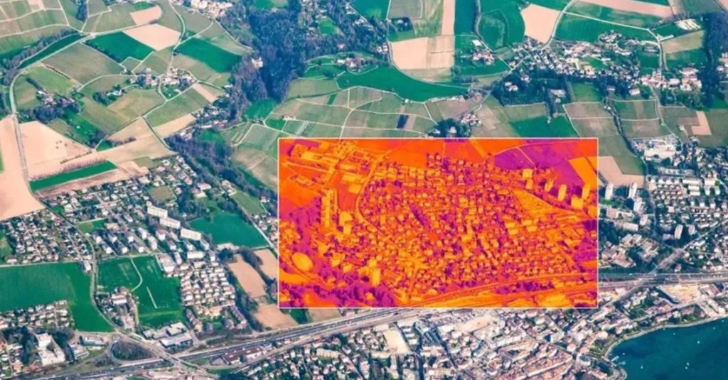
Vadodara’s city administration has implemented a comprehensive GIS-based platform that integrates geospatial data, sensor feeds, and public utilities across departments to support smarter decision-making. With over 3,000 km of roads, 700,000+ properties, and critical assets like stormwater lines and public utilities mapped with pinpoint accuracy, the platform is emerging as a powerful backbone for secure, responsive urban management.
Updated on: 16 July 2025

Sector

Solution
Technology

State of Origin
Impact Metrics
Real-time
coordinated emergency response enabled.
Reduces and improves
unauthorized excavation, infrastructure safety, and grievance redressal.
Aids and enhances
surveillance and pandemic containment through spatial intelligence integration.
Unlike traditional GIS systems designed solely for planning or land-use optimization, Vadodara’s GIS approach integrates live IoT data, CCTV feeds, GPS mapping, and field inputs. This convergence allows different municipal departments and emergency responders to view the same real-time map, ensuring coordinated action.
This plays a pivotal role in minimizing haphazard excavation, controlling unauthorized digging, and managing infrastructure vulnerabilities that could pose safety risks. By integrating approvals via the Plan Dig and Monitor (PDM) module, the system ensures multiple agencies don’t work at cross-purposes, a common issue in urban safety failures.
Multi-Layered Data Enables Rapid Emergency Response
The GIS platform supports over 70 thematic layers, including critical infrastructure like water lines, stormwater networks, hospitals, and transportation grids. When an incident occurs—such as a gas leak, water main break, or power outage—the city command center can:
- Instantly locate affected assets
- Identify surrounding risk zones (schools, hospitals, residential areas)
- Push alerts and coordinate containment across multiple departments
This functionality ensures response times are shortened, communication breakdowns are avoided, and resources are deployed to the exact location.
Grievance Mapping and Real-Time Redressal
Security also means making citizens feel heard. Vadodara’s grievance redressal system is built directly into the GIS layer. Citizens can:
- Click a geotagged photo
- Attach it to a complaint form
- Submit it via app or website
The platform automatically routes the issue to the right department, assigning urgency based on the nature of the complaint. For example, complaints related to public safety—like broken streetlights, missing manhole covers, or vandalized CCTV units—are prioritized for response.
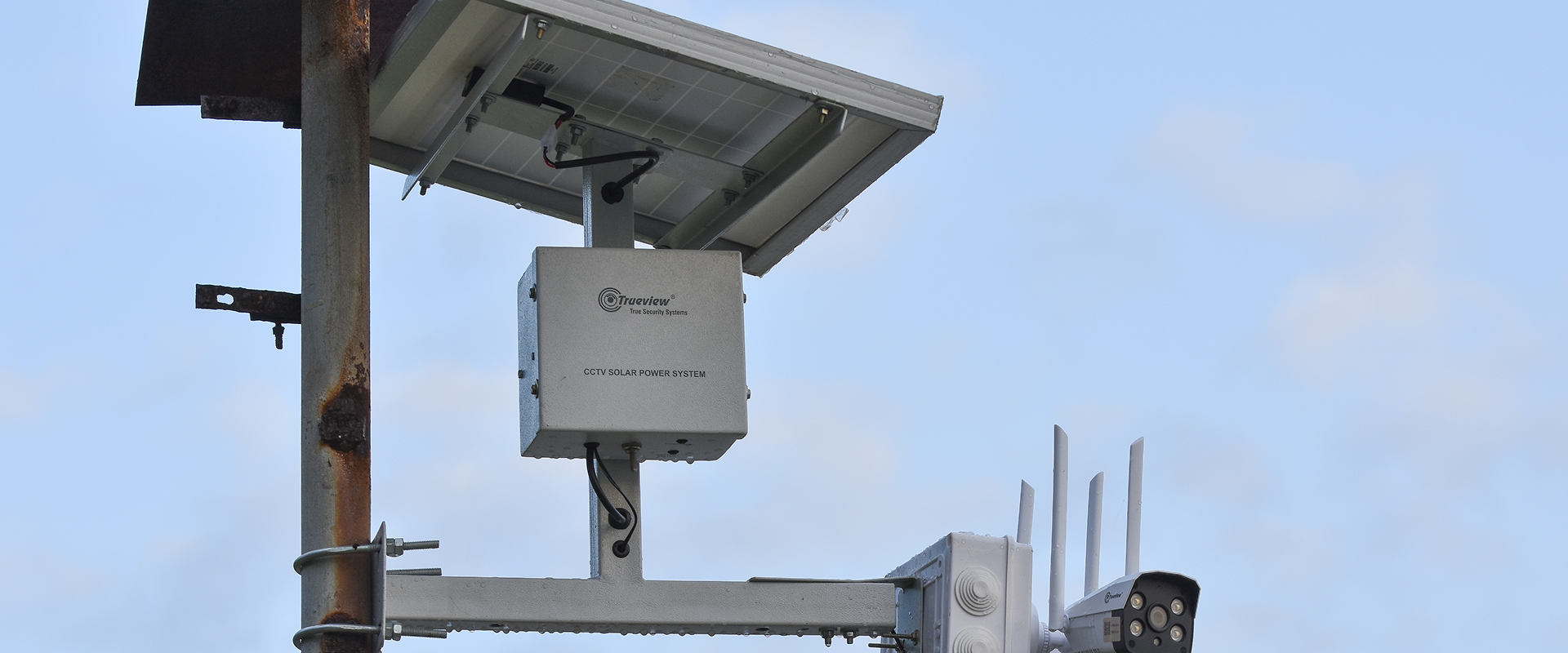
Smarter Surveillance Through Visual Intelligence
Vadodara’s GIS system also acts as a unified visual control panel, integrating with CCTV networks and environmental sensors. This brings enhanced:
- Crowd management during events
- Monitoring of high-risk areas (schools, flyovers, hospitals)
- Real-time surveillance in case of law enforcement emergencies
By visually layering live video with static geo-data, it supports evidence-based decision-making and better cross-departmental collaboration for managing everything from festivals to flash floods.
Citizen Awareness and Pandemic Response
During COVID-19, the same platform was used to track and visualize containment zones. It enabled the city to alert citizens and field staff about hotspots, reducing exposure risks. This adaptable use of GIS for public health shows how deeply security and safety are embedded into the system’s design.
Conclusion: GIS as an Urban Security Infrastructure
Vadodara’s GIS-based smart governance model goes beyond efficiency—it is a strategic safety enabler. By merging spatial intelligence with digital workflows and citizen participation, the system delivers real-time visibility, rapid incident response, and pre-emptive risk mitigation.
As more Indian cities work toward smart urban transformation, Vadodara offers a replicable model of how geospatial platforms can serve as both command center and safety net—keeping citizens protected while keeping the city moving.
Share Your Story Today, Shape Viksit Bharat Tomorrow
Got an idea, innovation, or experience that's making a difference? Share your story now and ignite India's transformation because your voice can drive the future forward!
BUILD YOUR OWN
BUILD YOUR OWN
How can I implement this innovation effectively?
How is this innovation being adopted around the world?
Where else could this innovation make an impact?
Who has seen real results from using this innovation?
What insights do experts share about this innovation?
What policies support or influence this innovation?
How could this innovation evolve in the future?
Is this innovation accessible and inclusive for everyone?
How can I contribute to or participate in this innovation?
What resources can help me explore this innovation further?
If you would like to know more about this innovation, fill this form to contact the innovator.
Handpicked stories tailored just for you
Explore stories that inspire, inform, and ignite new ideas across tech, innovation, and real-world impact


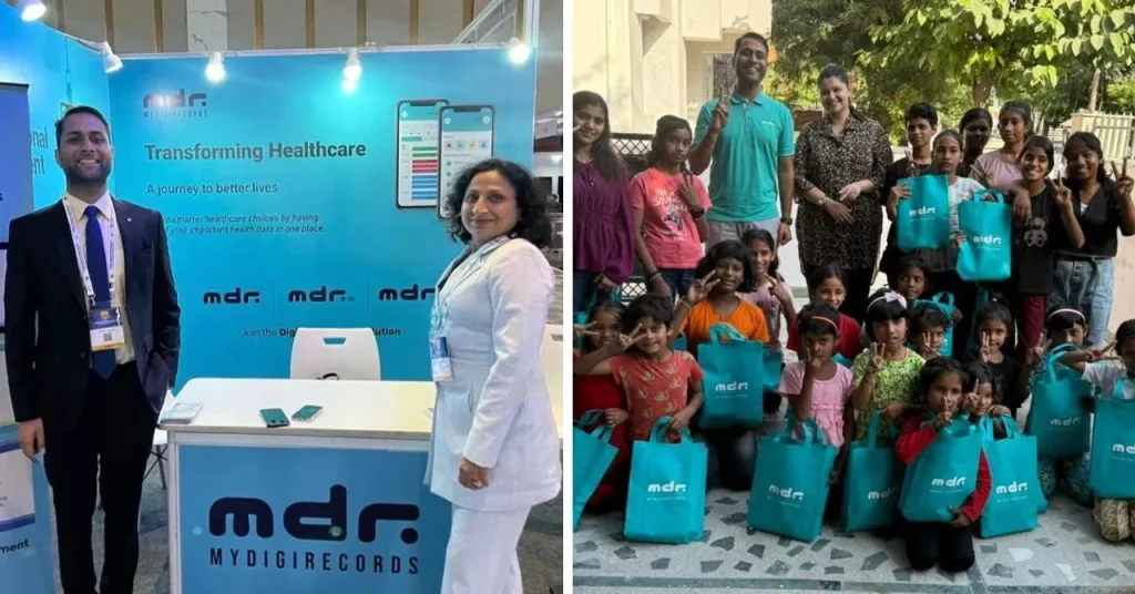
AI-Enabled Gynaecological Care Expands Access to 400,000+ Women Across India
Pinky Promise is a chat-first, AI-assisted women’s healthcare platform delivering affordable, confidential gynaecological care at scale. Founded in 2022, it...
Read More