
How Yatri Is Transforming Mumbai’s Public Transport Through Data and AI
With over 3 million downloads, Yatri has built a custom GPS, AI, and real-time data platform to track Mumbai’s local trains with remarkable precision. The technology is helping millions of commuters make better travel decisions while laying the groundwork for smarter urban mobility systems.
Updated on: 29 June 2026

Sector

Solution
Technology

State of Origin
Impact Metrics
3M+ downloads
making Yatri one of Mumbai’s most widely used public transport applications.
3,000+ local train services tracked
using a customised GPS infrastructure built specifically for Mumbai’s rail network.
Custom GPS technology deployed
across both legacy and modern train models.
AI- and machine-learning-powered tracking
used to map train rake numbers, route changes, and operational movements across the network.
Hailed as one of the busiest commuter rail networks, the Mumbai locals ferry 7.5 million passengers every single day. With its maze of tracks snaking their way across the city’s western, eastern, northern, southern and central corridors, one can only fathom how minutely controlled every train’s arrival and departure must be to make for a seamless flow.
You’ll agree it’s more than a transportation system; the network is a critical enabler of urban development. By moving these millions of passengers every day across the metropolitan region, the network allows people to live farther from commercial hubs while still accessing jobs, education, healthcare, and other essential services.
This connectivity supports the growth of multiple economic centres across the city instead of concentrating development in a single area.
Reliable train schedules are core to urban development in a city that’s as fast-paced as Mumbai, where trains are the beating heart of movement. A well-developed railway network promotes transit-oriented development, encouraging residential, commercial, and social infrastructure to grow around stations and improving the operational efficiency is essential for sustainable growth, economic productivity, and equitable access to opportunities.
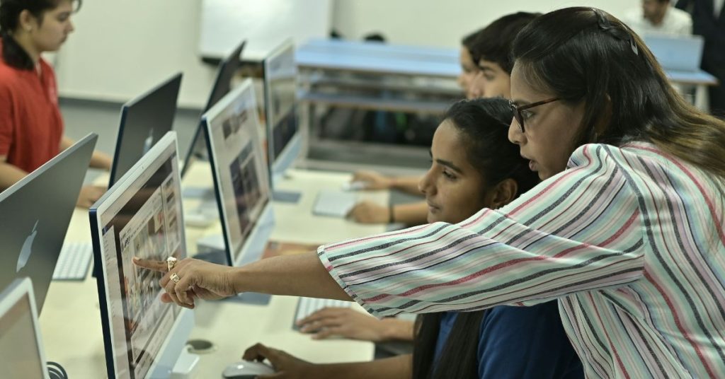
So, picture if this network were to be more nuanced, how it would speed up urban facilities. And two sisters, Reeva Sakaria and Lakhi Sakaria Chowdhary, decided to test the waters with their Yatri app.
Track trains in real time
Unlike conventional transit apps that rely on timetable-based information, Yatri built a customised GPS tracking system specifically for Mumbai’s local trains. The founders spent over 15 months developing and testing multiple hardware prototypes to create GPS devices that could function across both old and new train models operating on the city’s rail network.
The solution combines custom-built GPS hardware, Bluetooth sensors installed at stations, and software capable of processing vast amounts of location data in real time. Accuracy was critical, prompting extensive field testing where teams simultaneously travelled inside trains and monitored data externally to ensure minimal delays between actual train movement and app updates.

Artificial intelligence and machine learning further enhance the platform by helping map train rake numbers to constantly changing routes, sheds, and operating schedules. The app also uses geolocation to identify the commuter’s nearest station and voice-recognition technology that allows users to search routes by speaking station names aloud.
Beyond train tracking, Yatri integrates data from metros, buses, and other transport systems to power its multimodal journey planner. By combining hardware innovation, real-time data processing, AI, and user-centric design, Yatri has transformed fragmented transport information into a single digital mobility platform for Mumbai commuters.
Even after the technology was developed, the app had to undergo several rounds of rigorous testing before it was ready for public use. While algorithms and machine learning helped improve the system’s accuracy, real-world validation was critical to ensure reliable performance across Mumbai’s vast rail network.
The team conducted extensive field trials by deploying personnel both inside trains and at external monitoring points. Their role was to continuously compare the GPS data being transmitted by the tracking devices with the train’s actual movement on the ground. This process helped the founders identify discrepancies, refine the technology, and ensure that location updates were delivered in real time with virtually no delay.
Accuracy was particularly important because even minor lags could affect commuters’ ability to make informed travel decisions. The testing phase, therefore, focused on achieving highly precise train tracking under everyday operating conditions.
To ensure commuters receive timely updates during disruptions, the platform is also connected to railway operations. Information related to mega blocks, maintenance work, and service interruptions is communicated directly from railway control rooms, allowing the app to provide real-time alerts and maintain the reliability of its passenger information system.
What does this mean for Mumbai city and beyond?
Well, one is that commuters are able to know what time their trains will arrive. But this goes beyond a convenience standpoint.
The customised GPS devices, real-time data systems, and multimodal journey-planning capabilities developed for Mumbai’s local trains create a foundation that can be replicated across other cities and transport networks. As Indian cities invest heavily in metros, buses, suburban rail, and integrated transport systems, the need for a single platform that brings together fragmented mobility data will only grow.
The technology also opens up possibilities for smarter urban planning.
Real-time mobility data can help transport authorities understand commuter flows, identify bottlenecks, optimise schedules, and plan future infrastructure investments more effectively. Over time, such insights could support better station design, route planning, and crowd management.
Yatri’s future ambitions around ticketing further point towards the creation of a unified mobility ecosystem where journey planning, real-time tracking, payments, and service updates exist on a single platform.
If scaled successfully, the model could evolve into a digital public transport operating system for Indian cities. In doing so, it would not only make commuting easier but also help cities manage growing populations, improve public transport adoption, and build more efficient and connected urban environments.
Share Your Story Today, Shape Viksit Bharat Tomorrow
Got an idea, innovation, or experience that's making a difference? Share your story now and ignite India's transformation because your voice can drive the future forward!
Resources to Replicate This Idea
BUILD YOUR OWN
Do you want to know how this innovator scaled their idea, how much it cost them, and what resources/partnerships they deployed?
Handpicked stories tailored just for you
Explore stories that inspire, inform, and ignite new ideas across tech, innovation, and real-world impact

How Bharat-VISTAAR Is Connecting 140M+ Farmers to Smarter Agriculture
Bharat-VISTAAR is an AI-driven, voice-first platform that integrates trusted agricultural data to provide farmers with personalised crop, weather, market, and...
Read More